Reducing flood risk is an ongoing challenge for local governments. The National Flood Insurance Program (NFIP) has developed a means to assess flood risk and adjust flood insurance rates accordingly. Many of these steps, developed as a part of the Community Rating System (CRS) are policy oriented. That means local regulations, newsletters, outreach etc. Getting more points involves capital programs which cost much more money, so many local officials try to balance the tradeoff of capital versus insurance reductions. IT makes one wonder if the insurance loss might be a better means to assess, but that is a separate issue.
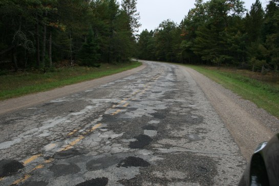
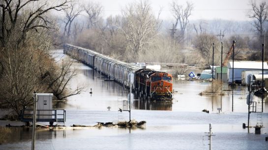
The development of capital projects means large amounts of water will be transferred from one point to another. Most communities look at trying to get the water out of their community as fast as possible, but this can have downstream impacts (or if you are the recipient, impacts form upstream that you cannot control). As a result, watershed plans are needed As a means to integrate local communities on a watershed basis. Note a watershed is not local stormwater, so a stormwater master plan is not a watershed plan. The watershed plan is a much larger effort, and one that normally included a means to fund basin-wide. Improvements. The latter is why few true watershed plans actually exist, which impacts the ability of local communities to increase their ratings.
To address the watershed element, USEPA published the Handbook for Developing Watershed Plans to Restore and Protect our Waters in 2008 to provide users with a comprehensive resource to develop more effective watershed plans. The goal was to improve and protect the nation’s water quality. However, the true benefit of watershed master plans extends well beyond this goal to include additional project opportunities that address water quality issues, low impact development, stream restoration, nature based park planning, mitigation banking, and conservation easements. Specific objectives include:
- Identify needs and opportunities related to flood risk, water quality issues, low impact development, stream restoration, mitigation banking, and conservation easements.
- Develop and assess proposed projects to address the identified needs and preserve identified opportunities.
Note this extends well beyond water quantity, given that large volumes flushed in a watershed can have adverse quality impacts (think water supply which from which 60% of public users get their raw water supplies – the turbidity is a huge treatment problem). In addition, plans are developed to inform using data-driven decision making using high-resolution data to create basin priorities, balance water quality, stormwater conveyance, and wildlife habitat program synergies and enable prudent spending of scare public funds.
According to the CRS Coordinator’s Manual, “the objective of watershed master planning is to provide the communities within a watershed with a tool they can use to make decisions that will reduce flooding from development on a watershed-wide basis.” Successful watershed master plans (www.floodsciencecenter.org) consists of:
- Evaluate the watershed’s runoff response from design storms of various magnitudes and durations under current and predicted future conditions,
- Assess the impacts of sea level rise and climate change,
- Identify wetlands and other natural areas throughout the watershed,
- Protect natural channels,
- Implement regulatory standards for new development such that peak flows and volumes are sufficiently controlled,
- Include specific mitigation recommendations that should be implemented in order to ensure that communities are resilient in the future, and
- Have a dedicated funding source like a stormwater utility in place in order to implement the mitigation strategies recommended by the plan.
One of the challenges is that watershed level planning crosses jurisdictional boundaries and are therefore challenging to get buy-in for. If parts of the watershed are outside the community’s jurisdiction, coordination with the other communities is required. In addition, hydrologic modeling is required to determine the present and future runoff conditions. Not all communities will have an individual on staff that is capable of completing this kind of effort.
Part 2 of this blog will outline the planning process.